Blogs
What's New Trending
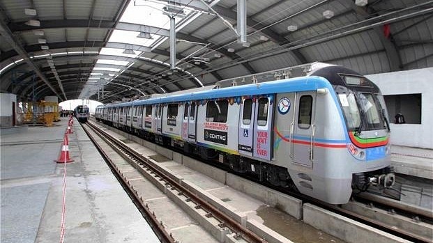
The dream of the metro of the city residents of Vijayawada will soon come true. The AP Metro Rail Corporation (APMRC), which has identified the need for 91 acres of land in NTR and Krishna districts for the construction of the metro corridor, recently met NTR District Collector G. Lakshmi and submitted proposals. Initially, it was planned to take up the construction of the Vijayawada Metro Rail in four corridors. However, the focus is currently on building two corridors from Gannavaram and Penamalur. Land acquisition will be done as per the proposals prepared earlier so that these two corridors meet at PNBS in Vijayawada.
The length of the first corridor is 26 kilometers. It starts from PNBS and connects Vijayawada Railway Station, passes through Eluru Road and reaches the national highway at Ramavarappadu and from there goes to Gannavaram. In this sequence, it travels via Yoga Ashram, Airport, Goodavalli, Chaitanya College, Nidamanur, MBT Center, Prasadampadu, Ramavarappadu intersections. After that, it turns onto Eluru Road and reaches Penmaluru via Gunadala, Padavala Revu, Machavaram Down, Sitarampuram Signal, Besant Road Railway Station.
The second corridor, which is 12.5 km long, starts from PNBS and goes via Bandaru Road, Benzi Circle, Auto Nagar, Kannur, Poranki to Penmaluru. In this sequence, PNBS passes through Bandaru Road, Victoria Museum, Indira Gandhi Stadium, Benzi Circle, Auto Nagar, Ashoka Nagar, Krishna Nagar, Kannur Center, Tadigadapa, Poranki to Penmaluru.

Get latest news and update

Leave a Reply
You must be logged in to post a comment.